SailSpeed is a great app for tracking your sail race or journey. It displays your sailing speed and heading with high visibility display for use in outdoor conditions and sunlight. Tracking of your race or journey is also on a map
Simply place your phone in a water tight casing on board of your boat, setup your settings and press start. The app will automatically keep tracking your progress, showing current speed and heading.
Enjoy your sailing, optimize your speed during the race and afterwards analyze your data.
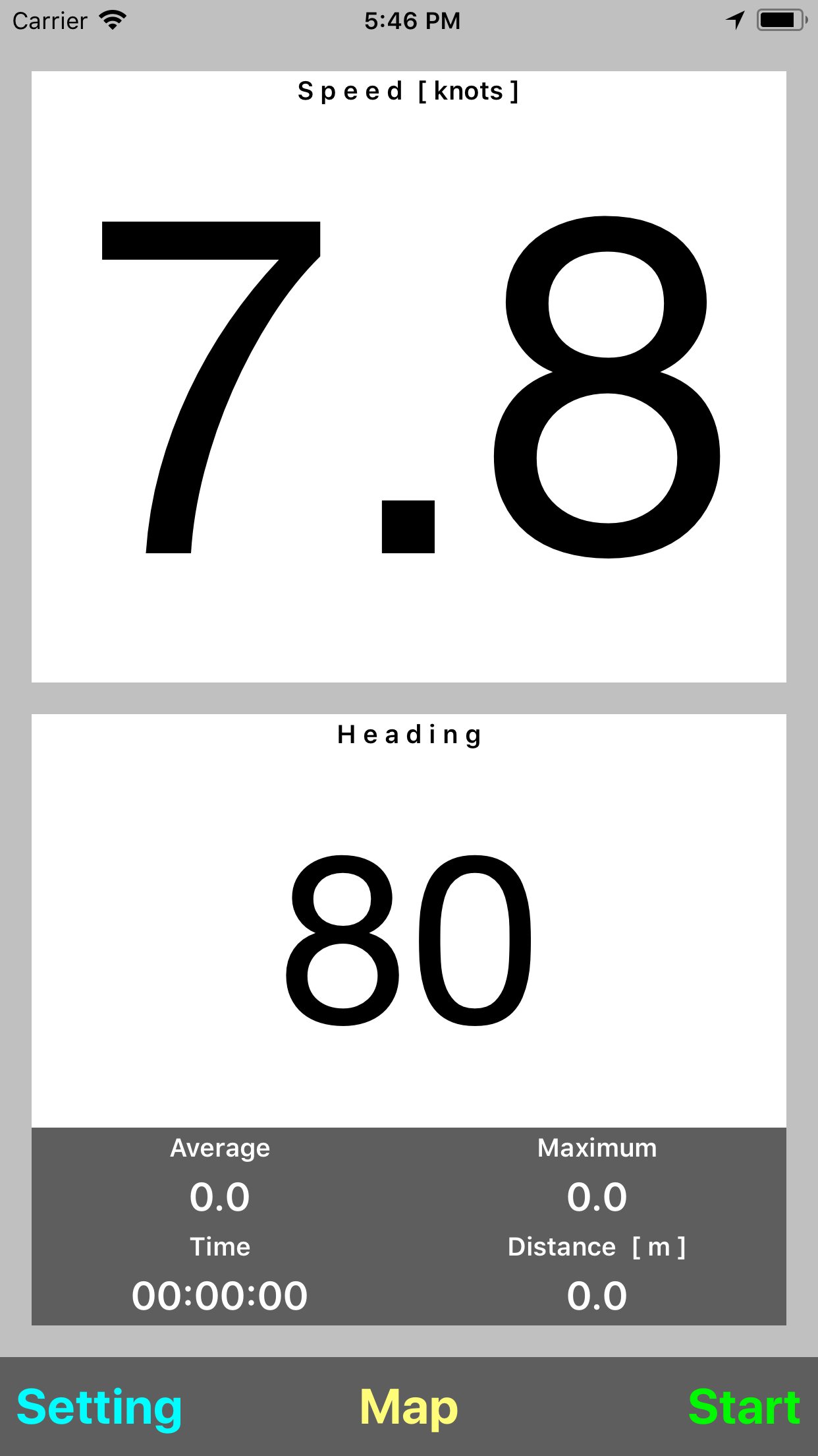
It has a display optimized for outdoor use and in sunlight conditions it will give you as much as contrast as possible.
It shows speed and heading and keeps track of race. The speed is shown in a high visible format and it is readable from great distance. Below the speed is the heading.
Press the start button when the race or your journey starts and the race tracker will monitor the average speed, maximum speed, elapsed time and the the distance covered.
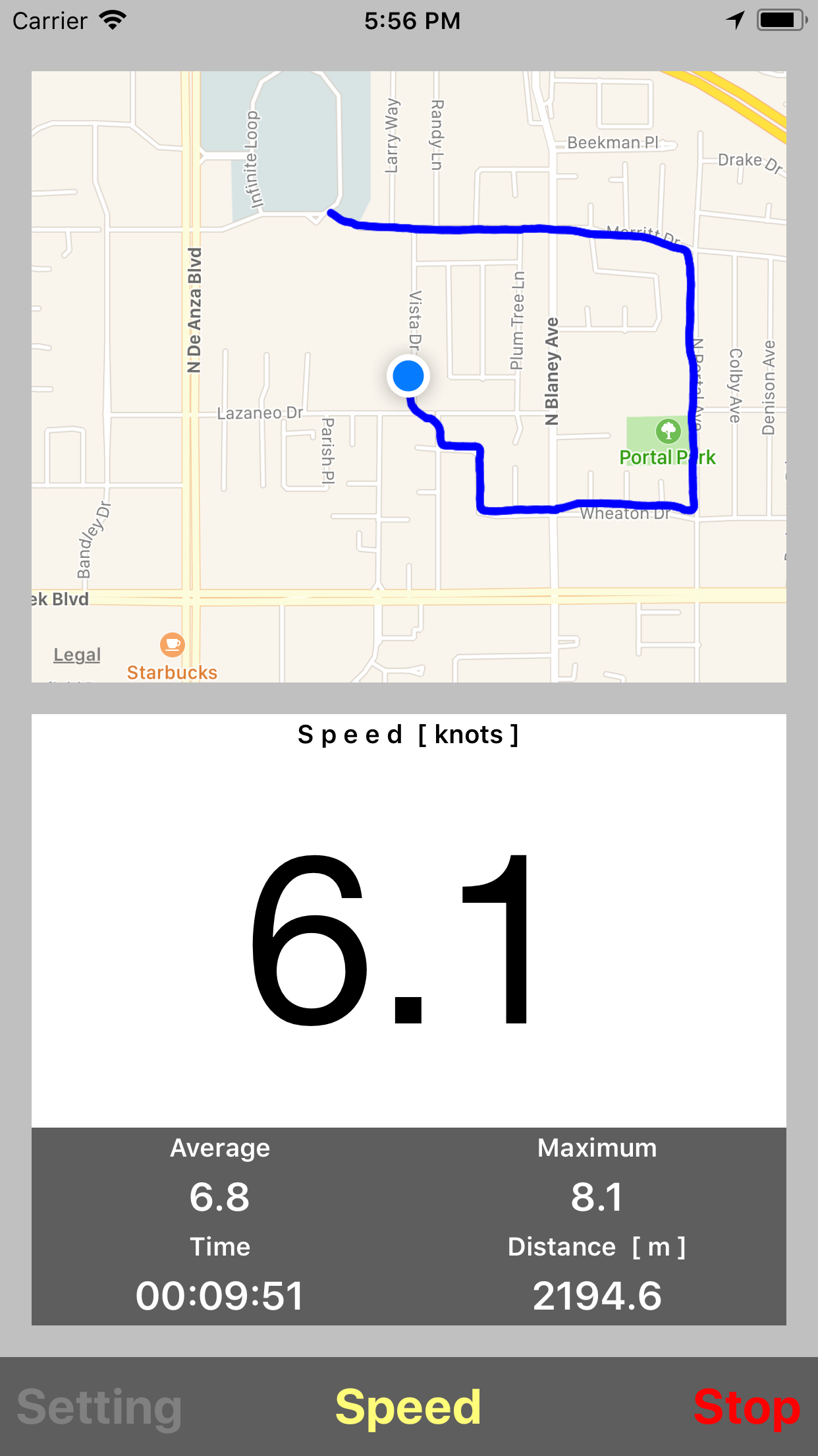
The app has also the ability to show a map and tracks the route in an overlay when map is selected and race is started.
Press the Map button in the middle and in the top part the map will be show. If tracking is activated the your track will be visible by a blue line.
When map is shown the button changes to speed. Press speed to return to the ignition overview and the map will be replaced by the speed window.
The map will automatically track your position when the race tracker is started. In the map mode the speed will be show in the heading window.
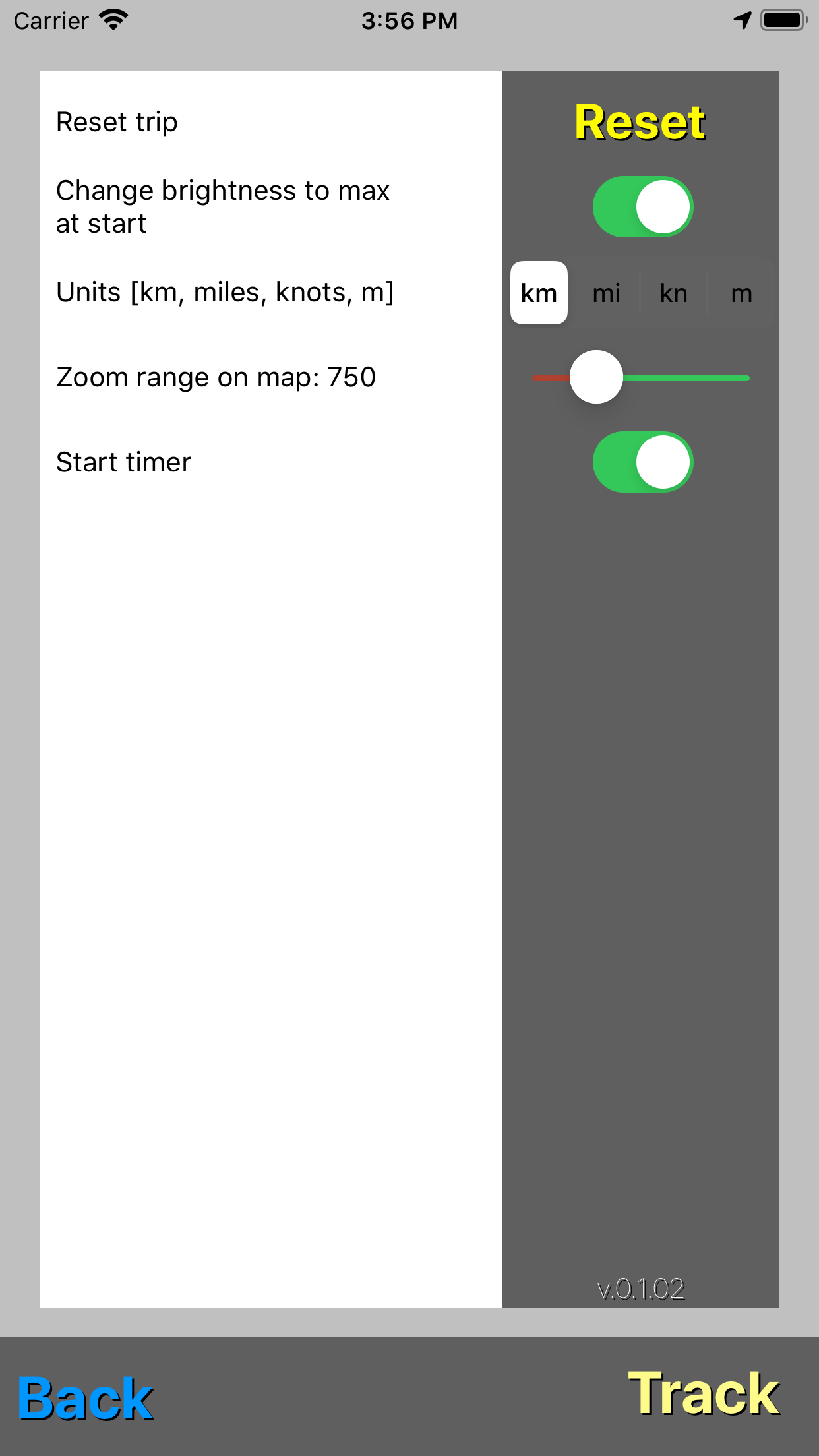
In the settings menu the user can select the units, and the scale of the map during the race tracking. The Setting menu is only accessible when the race tracking is stopped. In the Setting menu by pressing the Reset button all tracking parameters of your race or journey will be reset.
Below that is the option to select maximum brightness when you start tracking. Select this by moving the switch to the right. When returning to the tracking screen by pressing Back and starting a track automatically the screen will be put to maximum brightness.
Below that is the option for the zoom range when the map option is selected. By adjusting this slider the region shown on the map will be smaller or bigger accordingly.